September 14-16, 2022 —
Water-based national parks provide unique, once-in-a-lifetime experiences for nature enthusiasts. They are typically hard to reach and even harder to explore thoroughly. I got my first taste of these isolated, watery wonderlands with Maria in early 2022, during our trip to Florida. There, we explored Biscayne, Everglades, and Dry Tortugas. Each of these parks consist primarily of water and require some advance planning to enjoy fully. I thought that trip – particularly Dry Tortugas – would mark the peak of my water-based adventures in national parks. In September of 2022, Channel Islands National Park proved me wrong.


The Channel Islands sit off the coast of Los Angeles, surrounded by the Pacific Ocean. The national park – founded in 1980 – protects five of the eight islands. The islands and their surroundings were once ravaged by human activity, but recent conservation efforts have promoted an impressive rebound of marine life, endemic land animals, and native plant species. The islands now support a healthy ecosystem that is ripe with flora and fauna. With about 300,000 visitors in 2021, Channel Islands sees far fewer visitors than California’s other national parks. The islands can only be accessed via a paid ferry ride, which varies in duration from one hour to several hours depending on the destination island.
The islands are a paradise. They aren’t filled with stereotypical white sand beaches, but instead with huge mountains, dramatic cliff lines, fascinating sea caves, plentiful wildlife, and a blissful escape from society.
If you’re interested in learning the details about this trip and seeing some awesome photos, continue reading. If you want to watch the fun 10-minute video I made of the adventure (and see some snorkeling and kayaking footage), check out the YouTube video linked below.
A Change in Plans
Initially, my trip to Channel Islands was supposed to be a trip to Sequoia National Park. I applied to the Mount Whitney permit lottery with two of my high school best friends – Joe Peetz and Austin Glass – in hopes of summitting the peak during the summer. Our applications were unsuccessful, completely upending our original plan. Rather than cancelling, however, we replanned the trip into something even better.
In the following months, we worked out the details for our trip. After deciding that Sequoia was a no-go, we looked to Channel Islands National Park as an alternative. We nabbed campsites on Santa Cruz Island – the largest of the islands – booked a kayak tour, scheduled our ferry ride, purchased snorkeling gear and wetsuits, and sorted out flights & PTO. One of Joe’s roommates in Los Angeles – Chris – joined the trip as well.


I scheduled the trip for a mere week after my return from Rocky Mountain National Park. Two new national parks in the same month? Yes, please.
Austin and I flew into LAX on Tuesday, September 13. Joe picked us up and took us to an award-winning Thai place for dinner. Afterwards, we grouped up with Chris at Joe’s and Chris’ apartment and began preparing our bags for the next day.
Plan your trip to Channel Islands National Park
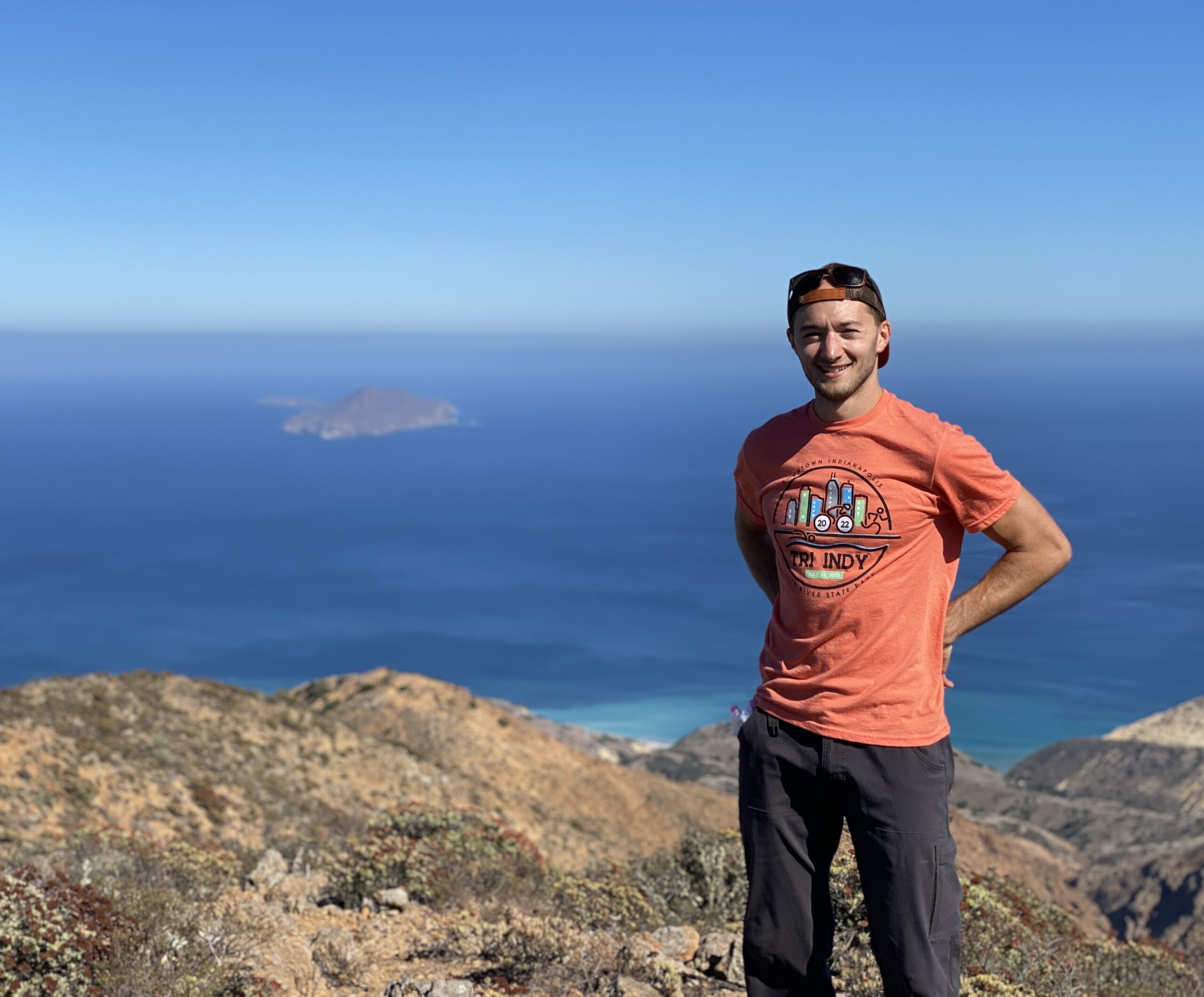
Day 1: Journey to Santa Cruz Island
We awoke early on the morning of September 14. Joe’s other roommate – Madox – graciously gave us a ride to the Island Packers dock in Ventura. There, we organized our gear as we waited to board. We boarded shortly before 9 AM, and the boat set off about ten minutes later. The captain warned us that the boat would be facing rough waters on the approach to Santa Cruz Island. This initially made me nervous, but once the boat made it into the Channel, that nervousness turned into adrenaline. All four of us stood out on the second deck as the boat hit huge waves and caught lots of air. For some, it may have been terrifying. For us, it felt akin to a roller coaster ride.


The island grew closer as the ferry continued to bounce on the waves. During the trip, the boat passed several schools of common dolphin. They swam up alongside the boat and jumped out of the water, exactly how you see in movies. I hadn’t seen a wild dolphin in over 15 years, so I was ecstatic.
My jaw dropped as we approached the island… I hadn’t realized how large and mountainous it was. The ferry reached Scorpion Anchorage just before 10:30 AM. Chris had fallen victim to seasickness and had vomited overboard, and Joe and I both felt nauseous after making the mistake of sitting down in the boat’s dining area. However, the beautiful morning, blissful winds, and abundant sunshine kept all of us in high spirits.
Island Foxes
The Channel Islands feature several animal species found nowhere else in the world. It didn’t take long for us to encounter one of these: the island fox. After our ranger-led orientation on the dock, we began searching for our campsite. We reached A018, where we pitched two tents and a hammock. As we organized our food and gear, one of the little foxes appeared and wandered through our site.

Island foxes evolved from the gray fox – found on the mainland – into a “pygmy species” that requires less food to survive. Though small, they are the top land predator on the Channel Islands. The Chumash people once kept island foxes as pets, leading the animals to develop a kindred nature towards humans. As such, they are easy to find on the island, and are not afraid to get close to people. They are absolutely adorable animals.
Unsurprisingly, we were all excited when we met our first one. I was able to get close enough to the fox to nab some solid photos. He was our unofficial greeter for the island.

Tour de Santa Cruz
Exploring Santa Cruz Island on foot is the best way to discover everything it has to offer. For our first day in the park, we planned to do exactly that. Once we finished setting up our campground, our group embarked on a 10-mile hike around the island. We planned to take the Scorpion Canyon trail to Montañon Peak and then detour to Potato Harbor. We walked to the visitor center to grab a hiking map, then began our hike around 1 PM.
Initially, I didn’t find much to appreciate on the hike. We walked through a collection of hills covered in sparse shrubbery and dried vegetation. The landscape resembled something found around Los Angeles, and wasn’t terribly impressive. The afternoon sun beat down on us, causing me to quickly work up a sweat. It didn’t take long for the scenery to change…

Once we reached the top of Scorpion Canyon, an expansive view of the Pacific Ocean, the distant mainland, and nearby Anacapa Island greeted us. A stiff westerly wind – almost constant in many places on the islands – cooled us down. Suddenly, I couldn’t stop staring at the scenery around us, and my apprehension turned into excitement.


Montañon Ridge
We began to climb steadily up the trail as our surroundings continued to captivate my gaze. We made a couple stops – one at an historic oil well and one for photos – before reaching the trail split for Montañon Ridge.
At the ridge, we discovered an incredible view of Santa Cruz Island’s western side. A mountainous ridge stretched into the distance until ultimately intersecting with the Pacific Ocean. The island is approximately 22 miles long from point to point. The National Park Service owns the eastern portion, which features two campgrounds, two anchorages (Scorpion on the east, Prisoners Harbor on the west), and the hiking trails we were currently utilizing. The Nature Conservancy owns the western portion, which stretches for nearly 15 miles beyond Prisoners Harbor.

As we gained elevation, the remainder of the island came into full view. Clashing air masses on either side of the ridge created a gorgeous fog/cloud cover. This resulted in a mystical ambiance that surrounded the other side of the island.

Montañon Peak
Once on the ridge, we began a traverse to the park’s highest point: Montañon Peak. Strong crosswinds attempted to blow our hats away as we hiked and soaked in the beautiful views.
At the peak, we deposited our packs – which Chris stood guard over in case of any opportunistic ravens – and gazed at the Pacific Ocean. Massive barges crossed the Channel near oil rigs to the north, with California’s mainland in the background. Anacapa Island stood proudly to the east, with its famous lighthouse visible.


We hadn’t encountered another soul in the last two hours, a trend that would continue until we returned to our campsite in the evening. The lack of people on the island made the hike a truly intimate and personal experience, one that stood in stark contrast to the crowds I had encountered at RMNP a week earlier.

Through the Meadows
At 4 PM, we started our descent from Montañon Peak towards Potato Harbor. We continued to enjoy the expansive view of western Santa Cruz Island in front of us. Mountains stretched as far as the eye could see, meeting the Pacific Ocean at their bases.
The rugged traverse eventually turned into a steady descent on an old dirt road through grassy meadows. Slowly, the trail snaked down the island and inched closer to the ocean. Distant cliff lines became clearer as we grew closer.

Potato Harbor
By 5:30, our group of four was nearing Potato Harbor. Through the wind, we could hear a pod of sea lions barking and large waves crashing against the cliffs.
Once we reached the edge of the cliffs, my jaw dropped.

Down below, we found coves resembling something you could find in the Mediterranean Sea. Steep and colorful cliffs met crystal clear blue-green water to create a view like out of a movie. The late afternoon sun added some yellow-orange color to the scenery, arguably making the area even more beautiful. Strong winds blew over the top of the cliff, nearly knocking us over. Austin, Joe and I spent some time absorbing and photographing the view while Chris retreated from the wind.


After getting our fill of Potato Harbor, we hurried back to the campground and reached it around 6 PM. There, we cooked dinner and enjoyed the evening air. I taught everyone Euchre – a card game popular in Indiana – in one of the tents as darkness set in. We went to bed early, ready for an activity-filled second day on the island.
Day 2: Exploring Cliffs and Kelp Forests
Our group started Day 2 with another hike, this time to Smuggler’s Cove. The cove is named for sea otter traders – known as contrabandistas – that smuggled around the back side of the island in the 18th and 19th centuries. Today, it is a peaceful beach that sees fewer visitors and more wind than Scorpion Anchorage on the opposite side of the island. We began the hike around 9 AM – intent on avoiding hikers brought by the 8 AM ferry – and embarked on a journey to Santa Cruz Island’s southern side.
Hiking to Smuggler’s Cove
The hike proved far more mellow than the previous day’s endeavor. Though it took 3.8 miles to reach Smuggler’s Cove, the elevation changes were much more gradual. We completed the one-way approach to the cove in just over an hour. When we reached the beach, we were still full of energy and had plenty of time to relax there.


At Smuggler’s Cove, large waves crashed onto the shore while we chilled under the shade of a small forest. Every time water receded from the beach, thousands of smooth rocks clunked into each other, creating an echo that resonated throughout the cove. Seabirds and ravens flew overhead as recreational vessels crossed the channel between Santa Cruz and Anacapa.
After we ate some snacks, Joe suggested we take a 3-mile detour to nearby Yellowbanks. Everyone agreed with the idea, and we departed from the cove.

Yellowbanks
The seemingly easy detour ended up being a taxing endeavor. Though short in distance, the elevation change was rather steep, and weeds and plants covered much of the trail. However, the detour proved worthwhile once we reached an overlook of the trail’s namesake beach.
We discovered blue-green water surrounded by a cove whose scenic nature rivaled Potato Harbor. We decided to forego hiking all the way down to the beach due to time constraints but snapped some photos of the overlook before beginning the return hike, just before noon.

No More Water
Our group maintained a 3+ miles-per-hour pace as we hiked back to Scorpion Anchorage. Unlike our previous hike, strong winds were scarce due to our location on the island. Without the wind to cool us off, we were sweating profusely in the early afternoon sun. This led us to consume water at a faster rate than anticipated on a hike several miles longer than we’d planned. As a result, we drained our water supplies (about 3 liters each) with one mile left in our journey.
Whoops.

Thankfully, the final mile was a simple, steady downhill trek to our campground. A couple of us started to feel faint and nauseous as we neared the hike’s end, but no one collapsed or showed any signs of dangerous dehydration. Once we reached our campsite, we hurried to the yellow jacket-guarded water spigot and chugged several liters of water. That was a close call.
“Let’s Go to the Beach, Beach…”
By 2:45 PM, we had quenched our thirst and eaten a much-needed lunch. Then, we began preparations for our next activity: snorkeling!
In preparation for the endeavor, I had acquired a heap of equipment: a full-face snorkel mask, a pair of flippers, a waterproof GoPro, and even a wetsuit. I was excited to take the full gamut of gear into the water to test it out.
Visit Paul in the Parks for more national park stories & travel tips!
We headed to Scorpion Anchorage around 3 PM and began changing into our wetsuits. After forcing the tight suit over my skin, I joined Joe, Austin, and Chris on the beach. There, we began final preparations for our journey into the kelp.

Among the Kelp
We jumped into the water at 3:30 and began a whimsical swim through the kelp forests near Scorpion Anchorage. As we swam, we encountered a plethora of fish, kelp stalks, and seagrass. Our wetsuits kept us warm in spite of the chilly water, making the swim pleasant and leisurely.
Every time I swam near or around kelp, their slimy leaves would brush up against my suit and my exposed hands and feet. The feeling was slightly unnerving but also exhilarating, as it immersed me in my weird and wild surroundings. The way the kelp moved with the waves mesmerized me, and was almost more fun to watch than the many fish that swam around me.
As time passed, the beach gradually cleared out. The last ferry departed the dock at 4 PM, taking the island’s day crowd back to the mainland. Before long, I began feeling a more intimate connection with the water and the abundant life it supported. Without other snorkelers and only the occasional beachgoer, I felt isolated from reality. In the moment, all that mattered was me, my three friends, and our fascination with the watery world around us. This was a moment that stood proudly with my favorite memories I’d made in the national parks.
Austin and Chris stopped snorkeling and headed back to our campsite around 5 PM. Joe and I stuck around a while longer. During that time, we encountered an even larger concentration of fish, including a large school that swam only a few feet away from us. If the sun hadn’t started setting, we could have easily stayed for another hour.


To see the best snorkeling footage I captured, skip to timestamp 1:56 in the YouTube video I linked above.
Sunset at Cavern Point
Joe and I hurried back to Scorpion Canyon Campground at 5:45 and rejoined Austin and Chris. There, we hastily cooked and ate dinner in an effort to catch the sunset at nearby Cavern Point. Without cell service, however, we weren’t able to check what time the sunset was. Our uncertainty sent us into a hurry.
At 6:30, we packed up our campsite and scurried up a steep trail near the campground to reach a cliff line looking west across the ocean. We reached the cliffs at 6:50, finding we had just barely made it in time to watch the sunset.
Nice timing.


We made our way along the cliffs towards Cavern Point while the sun quickly lowered to the horizon. A tremendous wind from the west drowned out our conversations and attempted to blow our clothes away. Eventually, we found a spot to watch the sun make its final descent. It disappeared behind the island only a few minutes after 7 PM, leaving a beautiful array of colors in its wake. We remained at Cavern Point for another half hour as we watched the sky change from one spectacular range of colors to the next.


Stargazing
Chris, Austin, Joe and I returned to our campsite around 8:00. There, Joe taught us a card game while the evening wind began to die down. At 9:30, we grabbed our headlamps and walked to Scorpion Anchorage to observe the night sky. As we walked, we saw the glow of island foxes’ eyes peering at us in the dark.
Back at the pier, we laid down and looked up at the night sky. Despite the island’s vicinity to major cities like Ventura and Los Angeles, we discovered a surprising lack of light pollution. This created a stunning display in the sky. We could clearly see the Milky Way framed by countless stars. I whipped out my “Sky Guide” app to help me and my friends find constellations, satellites, and planets among the stars.


Once we got our fill of the night sky, we returned to our campsite. We all passed out pretty quickly, exhausted from a day full of exciting activities.
Day 3: An Unforgettable Kayaking Adventure
At 5:30 AM, I woke up, grabbed my glasses and headlamp, and threw on my hiking boots. I began a solo journey back to Cavern Point to watch the sunrise on our last day in Channel Islands National Park. I reached the overlook at 6 AM. Over night, the hurricane-force winds that had battered us during sunset had died down to a light breeze. So, I was able to sit peacefully at Cavern Point and listen to distant bird calls as waves crashed into the cliffs below me.

I set my phone up on a concrete block and began a time lapse of the sunrise. Then, I kicked back and began enjoying the show. Watching the colors in the sky slowly change – while sitting alone with my thoughts and listening to the sounds of the ocean around me – was a calming and surreal experience.
The sun broke through the horizon just before 6:45 AM. I spent another 30 minutes at the overlook, watching the sun’s golden light bathe the island in warm colors.


I returned back to the campsite via the Cavern Point Loop trail at around 7:15. On the way back, I found several of the adorable island foxes. One of them was bravely traversing the edge of a cliff, above a 200-foot drop-off.
Back to the Ocean
When I returned to camp, I found Austin already awake. We pestered Chris and Joe until they woke up, and we got to work packing the campsite. Though we were in a hurry to get to the kayaking outfitter (Channel Islands Adventure Company), it didn’t stop us from having some fun…

We reached the outfitter at 9:45 AM. There, we deposited our gear in a bin and met our guide: Chuck. It was clear he’d been leading kayak tours for a long time, so I knew we’d be in good hands. He gave us an orientation at Scorpion Anchorage and we began our adventure at 10:30 AM. Since we had signed up for the Ultimate Sea Cave Kayak Tour – the longest tour offered on the island – we were ready for 5 hours of excitement and exhaustion. What I wasn’t ready for was one of the most amazing 5 hours of my life.
Skip to timestamp 4:00 in the YouTube video linked above to see the best of the kayaking footage I captured with my GoPro.


Into the Darkness
Our journey along Santa Cruz Island’s cliff lines began without hesitation. Within the hour, we ventured into our first proper sea cave: one of the largest in the world. Chuck took us in two at a time, and we navigated tight cave corridors using our headlamps and paddles while waves attempted to bash our kayaks into low ceilings.
Between the physical challenge of pushing my kayak through the water and around rock, the moody aesthetic of the dark cave, and the sensory immersion provided by the choppy sea water, the experience blew me away. It was incredible.


The best part? We had several more sea caves to explore. We’d only scraped the tip of the iceberg.
Sea Lions!
Over the next few hours, our group slowly made its way to Potato Harbor – about 3 miles away from Scorpion Anchorage. Along the way, we explored several more sea caves, observed a bald eagle, battled strong winds that kicked up large waves, and listened to Chuck tell us about the history of the national park. From him, I learned about the National Park Service’s intense conservation efforts in the park since its foundation in 1980. I also learned about the islands’ previous use by ranchers the islands’ geological history. I even learned how the pygmy species on the island – like the now-extinct pygmy mammoth and present-day island fox – arrived and evolved (mammoths could swim, did you know that?).
We reached Potato Harbor by 12:45 PM. Before paddling to the beach, however, Chuck guided us to a special treat nearby. A sea lion rookery – which we’d heard faintly while hiking two days earlier – sat just outside the harbor.
We rounded a rocky corner to find dozens – if not hundreds – of sea lions basking on the rocks and barking. Many of the younger sea lions grew curious about the strange kayakers when we approached their resting place. Before long, the young pups were jumping into the water and swimming around our group’s kayaks. They poked their heads out of the water, splashed their tails, and barked while we – delightedly – took photos and enjoyed the show around us.

The sea lion encounter only lasted about 10 minutes, but they were some of the best 10 minutes of my life. Seeing so many sea lions – undisturbed and flourishing without other people around – beat just about every wildlife encounter I’d experienced before.
Resting at Potato Harbor
After bidding farewell to the sea lions, Chuck led the group to the beach at Potato Harbor. There, we took 45 minutes to rest, eat, hydrate, and – for some – recover from seasickness. While we ate, Chuck entertained us with stories of his kayaking adventures around the Channel Islands. Several of those stories involved sharks and whales, making me a little nervous about our return journey. He assured us that encounters with large marine wildlife – especially sharks – were rare, which made me feel a little better.
Before we left, we nabbed some photos of the Mediterranean-like harbor. The colors of the rock and the water were unlike anything I’d seen in the United States… pictures don’t do it justice.


Back to Scorpion
At 2 PM, we returned to our kayaks and began our trek back to Scorpion Anchorage. On our way to Potato Harbor, Chuck had kept us close to the cliff line to optimize our encounters with caves and avoid a fight with the strong winds. On the way from Potato Harbor, we instead took a more direct route across the open ocean. With the wind at our backs, we rode on huge swells while paddling vigorously to stay on course. Members of our group drifted apart as we crossed a large stretch of ocean, but we eventually regrouped once we reached the base of Cavern Point.
After several miles of nonstop paddling – interrupted by a brief stop in one final sea cave – we reached Scorpion Anchorage at 3:30. There, we returned our kayaks and life jackets, thanked Chuck, and gathered our gear in preparation for the 4:30 ferry back to Ventura.
Goodbye, Channel Islands
At 4:20, we handed our camping gear to the ferry crew for storage on the boat’s lower deck. We found seats on the upper deck, and the boat departed about ten minutes later. The sun – already starting to set – created a bright glare in the boat’s wake. I stood at the aft end of the boat and watched Santa Cruz Island grow smaller as the boat sped away.

Though the Pacific Ocean was much calmer than it had been during our approach to the island two days ago, the boat ride was still exciting. We encountered a feeding frenzy – consisting of pelicans, seagulls, sea lions, and common dolphins – as we neared the mainland. A school of dolphins began swimming alongside our boat, guiding us to said frenzy. Visitors on the boat excitedly rose from their seats to photograph the friendly sea mammals, who swam around the boat and jumped out of the water frequently.
After the whimsical detour to see the feeding frenzy, we continued to shore. The boat arrived at 5:45 to the Island Packers’ dock, where we retrieved our belongings. We waited for Joe’s roommate Madox to pick us up. In the meantime, we shopped for souvenirs in the gift store while we reminisced on the incredible three days spent on Santa Cruz Island.
In Conclusion…
Two weeks after my trip to Channel Islands, I revisited Mammoth Cave National Park with my old friend and fellow national park enthusiast: Benjamin Peacock. During the trip, we discussed “awards” for national parks we’d been to, which each award covering a different category. One of these was “Most Surprising Park.” After some thought, I realized the answer was clear: Channel Islands National Park is far and away the most surprising national park I’d visited up until now.
When coming to the park, I had few – if any – expectations of what I’d find. Turns out, the lack of expectations served me well. My visit to Santa Cruz Island with Austin, Chris & Joe ranks as one of the most fulfilling visits I’ve ever paid to a national park. Everything we did surprised me in one way or another, and our diverse array of activities kept our three days on the island full of excitement.
Channel Islands National Park is a beautiful example of conservation done right. After decades of rehabilitative work done by the National Park Service and the Nature Conservancy, the national park is now a wonderland of diverse wildlife, plant life, and unique recreational opportunities for visitors. Its isolation from California’s mainland makes it a difficult park to reach, but those that make the effort to visit will find an experience unlike any other they’ve had before.

I can’t wait to return to Channel Islands National Park with Maria. Until then, I pray it continues to receive the respect, attention, and care that it deserves.
— Paul
Learn more about Channel Islands National Park
Return to my National Park Guide
Return to my National Park Journal